Inaccurate rendering of annotated agent's position on map

Hi,

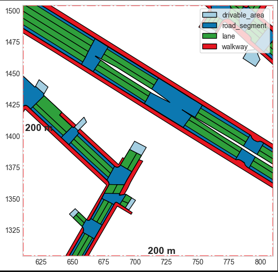
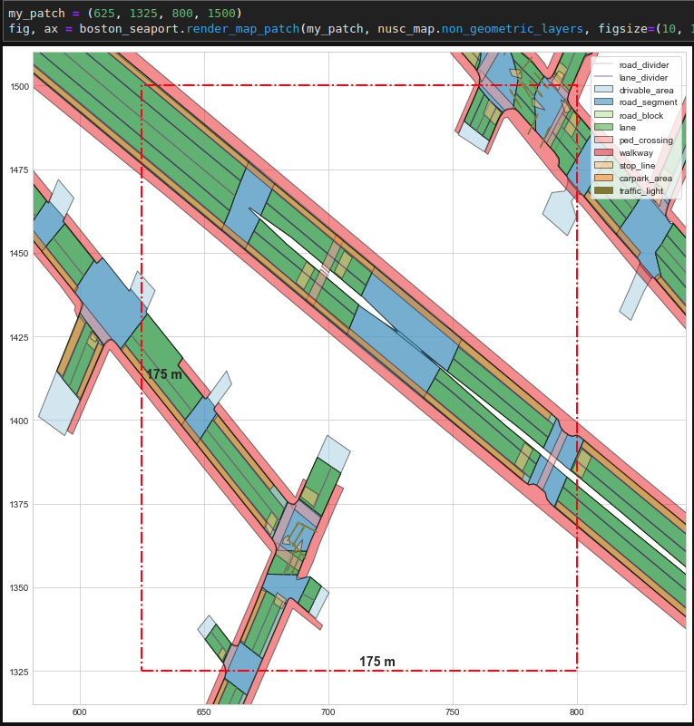
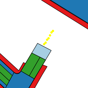
I’m having an issue when it comes to rendering position of an annotated agent on the top of the map (see image below). It seems that various agents are rendered outside of the actual map, positions extracted from annotations are correct as I checked it multiple times with respect to map coordinates. I was wondering if that is a common issue and if it can be solved?

Scene: 397
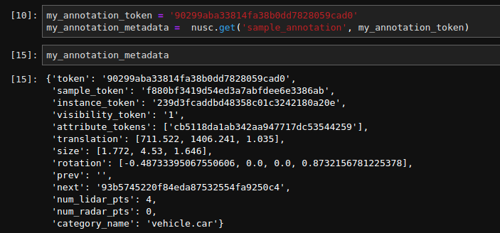
First Annotation Token: 90299aba33814fa38b0dd7828059cad0

img

Cheers,

What exact code did you use? We checked automatically for ego poses outside the driveable surface and found these: scene_blacklist = [499, 515, 517]

Hi,

I transform the output of nusc_map.render_map_patch() into the numpy array and then render the position on top of it with cv2.circle().

The rendered position is not derived from ego pose but rather from annotations, therefore, those rendered circles correspond to the annotated agent’s positions.

The image below corresponds to a map chunk (boston-seaport) on which the position is rendered. Some of positions of the annotated agent are:
X, Y
710.515, 1404.629
709.508, 1403.017
708.665, 1401.671
707.429, 1399.687

Thus, if you just look at the map and try to project the first two coordinates you can clearly see that those are outside of the actual driveable surface.

Also, you’ve mentioned that you’ve checked automatically for ego poses outside driveable zones, is the code for such identification released? If that’s the case I could just filter those annotations as well.

Cheers,

Hi,

Was wondering if you had a chance to look into this?

Cheers

So from this figure it looks like the annotations are on the connecting part between two roads that is not part of our map? I assume that is expected, we only annotate the parts that we drive on. In general our annotations need to stop somewhere, so there will always be such issues.

Hi,

That’s right it looks like the position of tracked agent (annotation) is on the connecting part. Also, this is indeed one of nuscene’s maps, more precisely boston-seaport.

The following shows the screenshot of metadata of the annotation where you can clearly see the translation vector and its values:

And below you can see another screenshot of retrieving map chunk on which the position can be rendered. Yet again, as I’ve pointed out before, the coordinates (x,y) fall out of the map.

Also, as I’ve mentioned above, if you have any advice on how to check for annotations or just positions basically (as you managed to do with ego) that fall out of the map to then blacklist them I would appreciate it.

PS:

I tried taking a screenshot of rendered sample to confirm with front camera sensor where exactly the annotated vehicle is but got the following error:

Cheers,

Hi

Any news on the issue?

Hi,

It’s been a while, any solutions to the discussed issues?

Hi. I just tried to find this on the map. I believe the issue is with this underpass: https://www.google.com/maps/@42.3492644,-71.0493384,3a,75y,28.68h,85.03t/data=!3m6!1e1!3m4!1sVFQcvDYImx7Ca-nEjUF26Q!2e0!7i16384!8i8192

The localization algorithm used here did not allow for 3d localization, hence we chose to remove that part of road from the map.

Hi,

That’s fine, I fixed the issue by simply going through all annotations, checking them visually and blacklisting any that pose such issue.

Cheers,

1 Like