
Hi, I’m trying to understand the relationship between road_segment and road_block layers in the map. My understanding so far is as follows:
- a
road_blockis always associated with aroad_segment(viaroad_segment_token) - when a
road_segmentis not intersection, there’s always at least 1road_blockwithin it - when a
road_segmentis intersection, there’s noroad_blockassociated with it (which makes sense because we can’t define traffic direction at an intersection)
I’m looking at the singapore-onenorth map to verify my understanding but interestingly I found some outliers. In this map, there’re 3 intersection road_segment that have road_block association. For example:
nusc_map.render_record('road_segment', '9ebcd1ea-4ea4-462e-847f-1e7563f4229d', other_layers=['road_block'])
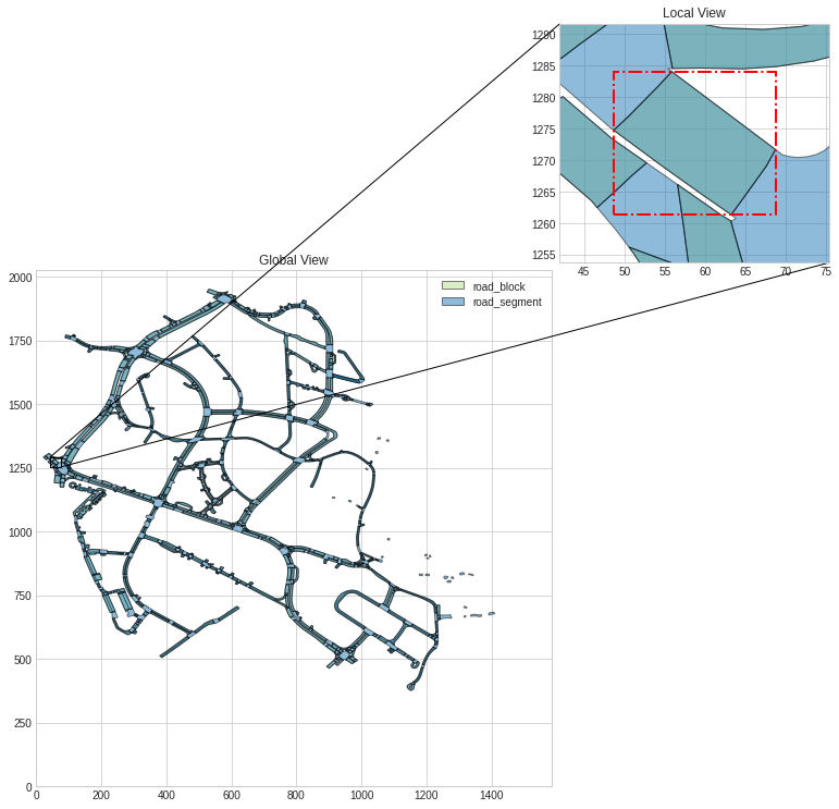
As shown above the road segment(‘9ebcd1ea-4ea4-462e-847f-1e7563f4229d’) and road block(‘25aab928-44b2-45b8-93e9-3414044b25f8’) share the same area, but when I look at the local patch overlayed on the lidar base map this polygon doesn’t look like an intersection.
The other two cases are similar with this one. So I wonder if the is_intersection field of these three records are incorrect?
Another relevant question is the relationship between lane and road_block, it seems reasonable to assume that lane is the building block of road_block, but the two are not linked in the dataset, I wonder if there’s any reason for this?
Thanks.