
I would like to align the data as per the Front camera. It would be great help, if you could share the details for below points
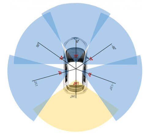
- The overlap of the FOV for all the sensors
- Is there a function to crop/merge the Top_Lidar and Radar’s data as per the front camera FOV? or how to perform this?
- While performing this, does the annotations of the camera, matches (identical) the cropped-Lidar and Radar data? if its not matched, how to correct this and have single annotation as per Front camera FOV?